Approximate Location Map
Large Map »
Latitude: 51.3621 / 51°21'43"N
Longitude: 0.3535 / 0°21'12"E
OS Eastings: 563947
OS Northings: 165183
OS Grid: TQ639651
Mapcode National: GBR NNJ.D7G
Mapcode Global: VHJLY.21R5
Plus Code: 9F329963+RC
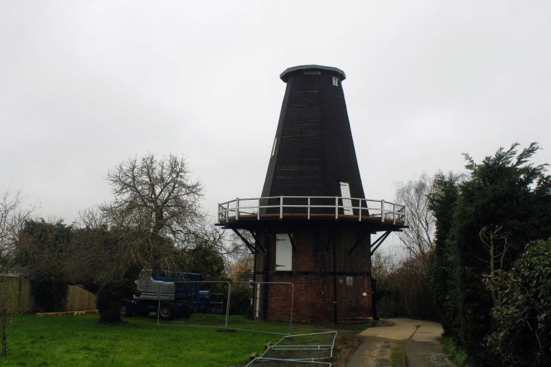
Entry Name: Meopham Windmill
Listing Date: 22 August 1952
Grade: II*
Source: Historic England
Source ID: 1054722
English Heritage Legacy ID: 356829
ID on this website: 101054722
Location: Meopham Green, Gravesham, Kent, DA13
County: Kent
District: Gravesham
Civil Parish: Meopham
Built-Up Area: Meopham
Traditional County: Kent
Lieutenancy Area (Ceremonial County): Kent
Church of England Parish: Meopham St John the Baptist
Church of England Diocese: Rochester
Tagged with: Windmill
TQ 66 NW
4/100
MEOPHAM
WROTHAM ROAD (west side)
Meopham Windmill
22.8.52
II*
1801 built by the brothers Killick. Smock mill. Lower two storeys red brick, upper three storeys weatherboarded. Four sweeps. Recently restored. Machinery complete and in working order.
Listing NGR: TQ6394765183
External links are from the relevant listing authority and, where applicable, Wikidata. Wikidata IDs may be related buildings as well as this specific building. If you want to add or update a link, you will need to do so by editing the Wikidata entry.


Other nearby listed buildings
