Approximate Location Map
Large Map »
Latitude: 52.0237 / 52°1'25"N
Longitude: -4.7958 / 4°47'44"W
OS Eastings: 208280
OS Northings: 239832
OS Grid: SN082398
Mapcode National: GBR CT.GM3S
Mapcode Global: VH2MZ.TDJH
Plus Code: 9C4Q26F3+FM
Entry Name: Nevern Bridge
Listing Date: 16 January 1952
Last Amended: 27 October 1992
Grade: II
Source: Cadw
Source ID: 12755
Building Class: Transport
ID on this website: 300012755
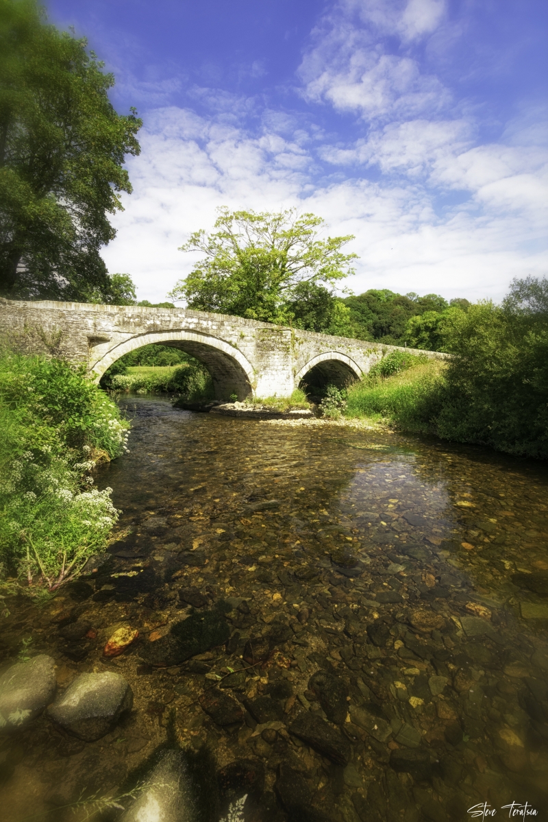
Location: Situated some 200m S of Nevern Church.
County: Pembrokeshire
Community: Nevern (Nanhyfer)
Community: Nevern
Traditional County: Pembrokeshire
Tagged with: Bridge
C18 to early C19 road bridge over Afon Nyfer, rubble stone and ashlar, humped. Two arches with slate capped ashlar cutwaters between. Larger S arch is substantially ashlar faced, both have cut stone voussoirs. Arches are recessed with keystones.
Bridge is, in ashlar part, similar to Pont Newydd but rubble stone over smaller arch and bend of larger arch suggests that centre and cutwaters may be rebuilt.
External links are from the relevant listing authority and, where applicable, Wikidata. Wikidata IDs may be related buildings as well as this specific building. If you want to add or update a link, you will need to do so by editing the Wikidata entry.


Other nearby listed buildings
