Approximate Location Map
Large Map »
Latitude: 51.9453 / 51°56'42"N
Longitude: -3.3863 / 3°23'10"W
OS Eastings: 304807
OS Northings: 228326
OS Grid: SO048283
Mapcode National: GBR YP.MNMY
Mapcode Global: VH6BZ.8C4L
Plus Code: 9C3RWJW7+4F
Entry Name: Chwarae Teg PH
Listing Date: 16 December 1976
Last Amended: 4 November 2005
Grade: II
Source: Cadw
Source ID: 85645
ID on this website: 300085645
Location: Roughly opposite Conway Terrace.
County: Powys
Town: Brecon
Community: Brecon (Aberhonddu)
Community: Brecon
Built-Up Area: Brecon
Traditional County: Brecknockshire
Tagged with: Pub
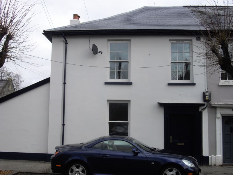
Early to mid C19 two-storey row.
No.21 has 12-pane sashes on first floor; on ground floor, doorway to R (broader than others) 4-panelled door. To L, sash window without glazing bars. No.21 also with one-storey lean-to addition against NW return; there is a continuation of the return elevation in a lower two-storey, two bay wing to the rear faced in roughcast.
A terrace of well-preserved earlier C19 houses. Group value with the many other listed buildings in The Watton.
External links are from the relevant listing authority and, where applicable, Wikidata. Wikidata IDs may be related buildings as well as this specific building. If you want to add or update a link, you will need to do so by editing the Wikidata entry.


Other nearby listed buildings
