Approximate Location Map
Large Map »
Latitude: 51.9445 / 51°56'40"N
Longitude: -3.3845 / 3°23'4"W
OS Eastings: 304931
OS Northings: 228237
OS Grid: SO049282
Mapcode National: GBR YP.MP3S
Mapcode Global: VH6BZ.9D36
Plus Code: 9C3RWJV8+Q5
Entry Name: The Watton
Listing Date: 16 December 1976
Last Amended: 4 November 2005
Grade: II
Source: Cadw
Source ID: 85592
ID on this website: 300085592
Location: On corner with Borderers Way.
County: Powys
Town: Brecon
Community: Brecon (Aberhonddu)
Community: Brecon
Built-Up Area: Brecon
Traditional County: Brecknockshire
Tagged with: Building
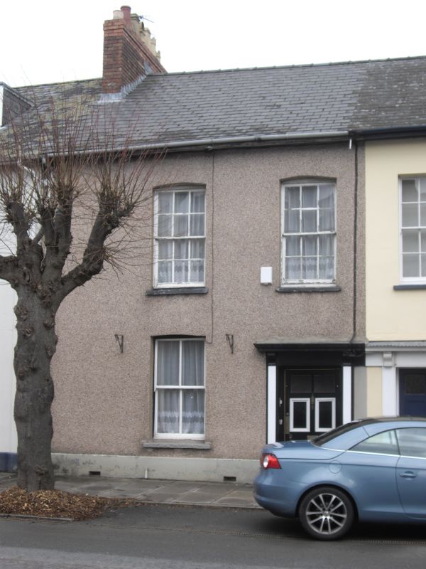
Group of early C19 houses forming the end of the block comprising 1-14 The Watton.
No.2 has two 12-pane hornless sash windows with cambered heads on first floor, and 4-pane horned sash window to L on ground floor. Doorway to R; doorcase with bracketed cornice; 6-panelled door with glazed upper panels.
One of six well-preserved early C19 houses retaining overall late Georgian character. Group Value both with rest of group and with other listed buildings in The Watton.
External links are from the relevant listing authority and, where applicable, Wikidata. Wikidata IDs may be related buildings as well as this specific building. If you want to add or update a link, you will need to do so by editing the Wikidata entry.


Other nearby listed buildings
