Approximate Location Map
Large Map »
Latitude: 51.6709 / 51°40'15"N
Longitude: -3.2395 / 3°14'22"W
OS Eastings: 314379
OS Northings: 197626
OS Grid: ST143976
Mapcode National: GBR HV.5XJF
Mapcode Global: VH6DD.S8RG
Plus Code: 9C3RMQC6+85
Entry Name: Stable at Cascade House drive
Listing Date: 18 July 2001
Last Amended: 18 July 2001
Grade: II
Source: Cadw
Source ID: 25529
Building Class: Domestic
ID on this website: 300025529
Location: Near the entrance of the drive to Cascade House
County: Caerphilly
Community: Gelligaer
Community: Gelligaer
Locality: Pen-pedair-heol
Built-Up Area: Ystrad Mynach
Traditional County: Glamorgan
Tagged with: Stable
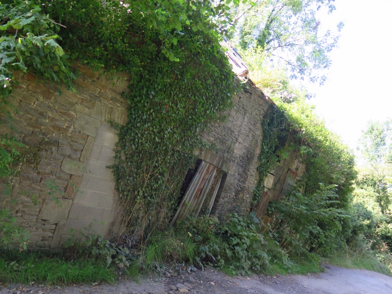
Cast iron plate on front records 'John Perrott 1838'. He was the owner of Cascade House at the time of the Tithe Apportionment of 1842, the farm then let to Thomas Lewis with Pen y Daren. Straight joints and differing masonry style show later extensions, with some other signs alteration or repair. John Perrott inscription is also on barn range at nearby Rhos-yr-wyfa.
Stable block, of narrow-coursed rubble with tooled ashlar dressings, rough stone voussoirs, and Welsh slate roof, not intact. Centre right cambered-headed stable door with window to left and loft opening above; at end left a wide arched cart or carriage bay with double doors; lean-to wing to left with 2 similar doorways, similar to right with single door. Ventilation slit in loft gable end.
Included as an unusually dated early - mid C19 stable, retaining its character, with close connections to and for group value with Cascade House.
External links are from the relevant listing authority and, where applicable, Wikidata. Wikidata IDs may be related buildings as well as this specific building. If you want to add or update a link, you will need to do so by editing the Wikidata entry.


Other nearby listed buildings
