Approximate Location Map
Large Map »
Latitude: 51.6837 / 51°41'1"N
Longitude: -3.341 / 3°20'27"W
OS Eastings: 307384
OS Northings: 199173
OS Grid: ST073991
Mapcode National: GBR HQ.52BM
Mapcode Global: VH6D5.1YL5
Plus Code: 9C3RMMM5+FH
Entry Name: Barn Range at Aberfan Fawr Farmhouse
Listing Date: 3 September 1997
Last Amended: 17 February 2003
Grade: II
Source: Cadw
Source ID: 18864
Building Class: Agriculture and Subsistence
ID on this website: 300018864
Location: Parallel and opposite (to N) of Aberfan Fawr Farmhouse
County: Merthyr Tydfil
Town: Merthyr Tydfil
Community: Merthyr Vale (Ynys-wen)
Community: Merthyr Vale
Locality: Aberfan
Built-Up Area: Aberfan
Traditional County: Glamorgan
Tagged with: Barn
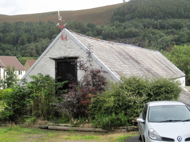
Barn and byre range under single roof, possibly mid C18 altered in C19.
Barn and lofted byre, rubble stone, single roof, corrugated iron on N side, slate on S. Barn to left has full-height double doors with timber lintel under eaves. Byre to right (continuous stonework) has 4 small square loft windows, ground floor door to left with pine lintel. Older door under second loft window with lower head and oak lintel, now window, and another oak lintel apparently of door set very low between third and fourth upper windows, also now window at ground level. W gable end has loft door with C19 bricks to right jamb. Dripstone over. Rear S has outshut under continuous roof behind byre. Barn E end has long slit opening in gable.
Interior not inspected, in 1997 said to have altered 3-bay cowhouse at upper end and 3-bay barn below, with rough roof-trusses with lapped and pegged collars.
Included as a barn and lofted byre range possibly of the mid C18, rare in the region. Group value with the farmhouse.
External links are from the relevant listing authority and, where applicable, Wikidata. Wikidata IDs may be related buildings as well as this specific building. If you want to add or update a link, you will need to do so by editing the Wikidata entry.


Other nearby listed buildings
