Approximate Location Map
Large Map »
Latitude: 52.6609 / 52°39'39"N
Longitude: -3.1465 / 3°8'47"W
OS Eastings: 322554
OS Northings: 307638
OS Grid: SJ225076
Mapcode National: GBR B0.5G09
Mapcode Global: WH79P.MCWX
Plus Code: 9C4RMV63+9C
Entry Name: Sundial in churchyard at Church of St Mary
Listing Date: 29 February 1996
Last Amended: 29 February 1996
Grade: II
Source: Cadw
Source ID: 16643
Building Class: Gardens, Parks and Urban Spaces
ID on this website: 300016643
Location: Opposite the main S door of the Church of Saint Mary.
County: Powys
Community: Welshpool (Y Trallwng)
Community: Welshpool
Built-Up Area: Welshpool
Traditional County: Montgomeryshire
Tagged with: Sundial
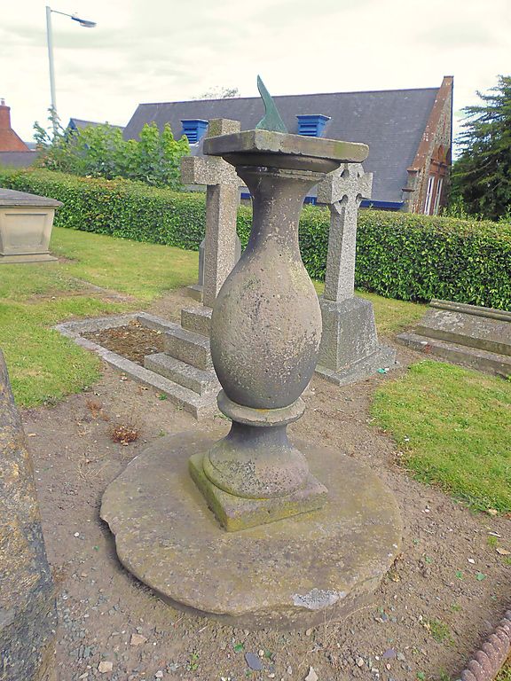
Description: Probably C18. Stone balustrade type, raised on a circular stone base, and with square top plate, which carries a copper dial.
A good example of a C18 sundial, which forms part of a group with the Church of Saint Mary, the churchyard walls, and the war memorial.
External links are from the relevant listing authority and, where applicable, Wikidata. Wikidata IDs may be related buildings as well as this specific building. If you want to add or update a link, you will need to do so by editing the Wikidata entry.


Other nearby listed buildings
