History in Structure

Cowshed at Lower Maestorglwydd

A Grade II Listed Building in Llanigon, Powys

More Photos »
Approximate Location Map
Large Map »

Coordinates

Latitude: 52.03 / 52°1'47"N

Longitude: -3.1531 / 3°9'11"W

OS Eastings: 320984

OS Northings: 237469

OS Grid: SO209374

Mapcode National: GBR F0.G6HS

Mapcode Global: VH6BQ.97FN

Plus Code: 9C4R2RHW+XP

Entry Name: Cowshed at Lower Maestorglwydd

Listing Date: 20 June 1995

Last Amended: 20 June 1995

Grade: II

Source: Cadw

Source ID: 16119

Building Class: Agriculture and Subsistence

ID on this website: 300016119

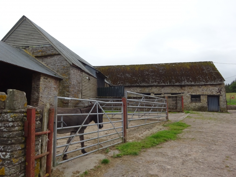
Location: The cowshed stands detached from the house and at one end of it.

County: Powys

Community: Llanigon

Community: Llanigon

Locality: Maestorglwydd

Traditional County: Brecknockshire

Tagged with: Cowshed

Find accommodation in
Llanigon

Exterior

Dated 1677, it makes an L-plan with the barn and is built of stone with a corrugated asbestos roof. It is of one storey with a loft and has a stout doorframe facing N inscribed "1677 WG" on the timber lintel. There are other old/original timber-lintelled openings facing N. Within, the roof is original, with tiebeams and diagonal struts to the principal rafters.

Reasons for Listing

The cowshed is an early farm building and of special interest for bearing a date and initials. It is included for group value with Lower Maestorglwydd Farmhouse.

External Links

External links are from the relevant listing authority and, where applicable, Wikidata. Wikidata IDs may be related buildings as well as this specific building. If you want to add or update a link, you will need to do so by editing the Wikidata entry.

Recommended Books

Other nearby listed buildings

  • II Barn at Lower Maestorglwydd
    The barn stands within the group of farm buildings; if forms an L-shape with the listed cowshed and has a later single-storey stone shed against its N end.
  • II Lower Maestorglwydd
    Llanigon
  • II Wainhouse at Lower Maertorglwydd
    The wainhouse stands on the edge of the farm buildings and is separated from the others to W by the lane.
  • II* Middle Maestorglwydd House
    The house stands set back from the lane and at an angle to it, roughly opposite traditional farm buildings and attached to another.
  • II* Middle Maestorglwydd Barn
    The barn stands adjacent and at an angle to the lane, some 250 metres NNE of Middle Maestorglwydd.
  • II Upper Maestorglwydd Farmhouse
    The house stands adjacent to a small group of farm buildings at the top end of a private track.
  • II Windsor Castle Cottage (Ty twyn)
    Located on the elbow of the lane from Felindre and Tregoyd, climbing on to Tregoyd Common.
  • II Cefn Farmhouse
    Located behind farmbuildings, on the NW facing slope of the hill rising on to Common bychan. The house is attached to other farm buildings, at the upper end of a small rectangular farmyard.

BritishListedBuildings.co.uk is an independent online resource and is not associated with any government department. All government data published here is used under licence. Please do not contact BritishListedBuildings.co.uk for any queries related to any individual listed building, planning permission related to listed buildings or the listing process itself.

British Listed Buildings is a Good Stuff website.