History in Structure

Church House

A Grade II Listed Building in Presteigne, Powys

More Photos »
Approximate Location Map
Large Map »

Coordinates

Latitude: 52.2746 / 52°16'28"N

Longitude: -3.0042 / 3°0'15"W

OS Eastings: 331580

OS Northings: 264522

OS Grid: SO315645

Mapcode National: GBR B6.YT6R

Mapcode Global: VH772.W354

Plus Code: 9C4R7XFW+R8

Entry Name: Church House

Listing Date: 26 March 1985

Last Amended: 26 March 1985

Grade: II

Source: Cadw

Source ID: 8828

Building Class: Domestic

ID on this website: 300008828

Location: Occupying a prominent island site with elevations to Broad Street and to St. Andrews Churchyard.

County: Powys

Community: Presteigne (Llanandras)

Community: Presteigne

Built-Up Area: Presteigne

Traditional County: Radnorshire

Tagged with: House

Find accommodation in
Presteigne

History

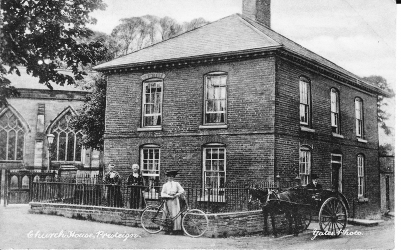
Before 1832 (appears in J.M.Ince's view of 1832).

Exterior

2 storey late Georgian brick house with hipped slate roof, centre brick stack, bracket eaves, band course.
3 windows to both elevations, cambered brick heads to double-hung sashes with glazing bars, shallow reveals. 6-panel door in modern glazed surround to street, 6-panel door under arched hood on brackets towards churchyard.
Earlier brick extension on east side.
Railed forecourts to churchyard and scallions elevations.

Reasons for Listing

Group value.

External Links

External links are from the relevant listing authority and, where applicable, Wikidata. Wikidata IDs may be related buildings as well as this specific building. If you want to add or update a link, you will need to do so by editing the Wikidata entry.

Recommended Books

Other nearby listed buildings

  • II Base of Cross at St. Andrew's Churchyard
    Presteigne
  • II Roseland
    At the end of a continuous row of cottages running uphill to Ave Maria Lane, open ground to left.
  • II Ivy House
    Plain cottage to street adjoining the gable of No 1 Church View.
  • II Church View
    Gable-fronted cottage, partly overlaid by roof of terraced row to right.
  • II 2-5 (Consec nos.) Church View
    Part of a mid C19 terraced row, stepped uphill to right and merging with No 1 Church View on left.
  • II Garden Wall at The Old Rectory
    Along street line, now heavily over grown.
  • I St Andrew's Church
    In a spacious churchyard close to the River Lugg with Broad Street low down east and Church Street to north-west.
  • II Church View
    Pair of cottages (formerly three), at end of a row and stepped forward from Oak Villars adjoining uphill.

BritishListedBuildings.co.uk is an independent online resource and is not associated with any government department. All government data published here is used under licence. Please do not contact BritishListedBuildings.co.uk for any queries related to any individual listed building, planning permission related to listed buildings or the listing process itself.

British Listed Buildings is a Good Stuff website.