Approximate Location Map
Large Map »
Latitude: 51.9471 / 51°56'49"N
Longitude: -3.3921 / 3°23'31"W
OS Eastings: 304414
OS Northings: 228535
OS Grid: SO044285
Mapcode National: GBR YP.MF77
Mapcode Global: VH6BZ.5B26
Plus Code: 9C3RWJW5+R5
Entry Name: Front Wing of St Michael's Hall
Listing Date: 16 December 1976
Last Amended: 4 November 2005
Grade: II
Source: Cadw
Source ID: 7148
Building Class: Religious, Ritual and Funerary
ID on this website: 300007148
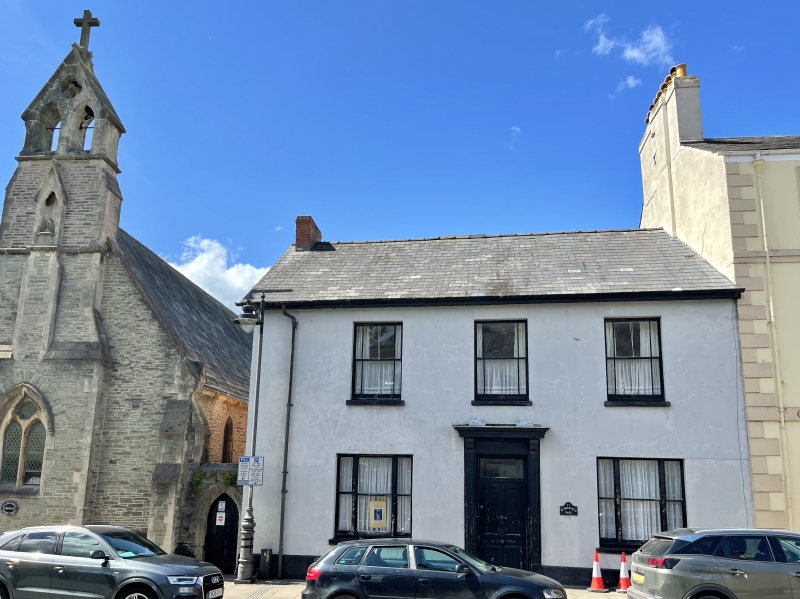
Location: Immediately to R of St Michael's Church.
County: Powys
Town: Brecon
Community: Brecon (Aberhonddu)
Community: Brecon
Built-Up Area: Brecon
Traditional County: Brecknockshire
Tagged with: Architectural structure
Later C19.
Stuccoed facade to Wheat Street of 2 storeys, 3 windows. Slate roof. On first floor, three sash windows with marginal glazing bars and horns. Two tripartite sash windows on ground floor each flanking central doorway with fluted pilasters and cornice on console brackets; rectangular fanlight; four-panelled door. Return wall of stone.
Included for group value with St Michael's Church and adjacent listed buildings.
External links are from the relevant listing authority and, where applicable, Wikidata. Wikidata IDs may be related buildings as well as this specific building. If you want to add or update a link, you will need to do so by editing the Wikidata entry.


Other nearby listed buildings
