Approximate Location Map
Large Map »
Latitude: 51.9462 / 51°56'46"N
Longitude: -3.3903 / 3°23'25"W
OS Eastings: 304537
OS Northings: 228435
OS Grid: SO045284
Mapcode National: GBR YP.MFPT
Mapcode Global: VH6BZ.6B1W
Plus Code: 9C3RWJW5+FV
Entry Name: Garden Wall to rear of No 5
Listing Date: 16 December 1976
Last Amended: 4 November 2005
Grade: II
Source: Cadw
Source ID: 6898
Building Class: Domestic
ID on this website: 300006898
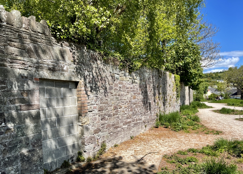
Location: To rear of No 5 Glamorgan Street; best seen from Captain's Walk.
County: Powys
Town: Brecon
Community: Brecon (Aberhonddu)
Community: Brecon
Built-Up Area: Brecon
Traditional County: Brecknockshire
Tagged with: Wall
Late C18 to C19, built after decay and destruction of town wall in C18 and built probably roughly on line of medieval town wall.
Tall stone wall; stone slab capping. Blocked doorway.
Wall on or close to line of Medieval town wall of Brecon. Group Value with Nos 5 & 6 Buckingham Place, and other sections of listed walls forming boundary between houses in Glamorgan Street and Captain's Walk.
External links are from the relevant listing authority and, where applicable, Wikidata. Wikidata IDs may be related buildings as well as this specific building. If you want to add or update a link, you will need to do so by editing the Wikidata entry.


Other nearby listed buildings
