Approximate Location Map
Large Map »
Latitude: 56.2119 / 56°12'42"N
Longitude: -2.7314 / 2°43'53"W
OS Eastings: 354731
OS Northings: 702389
OS Grid: NO547023
Mapcode National: GBR 2T.DQ8Y
Mapcode Global: WH7ST.04M6
Plus Code: 9C8V6769+QC
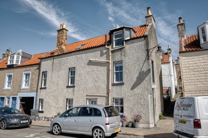
Entry Name: 37 Mid Shore, Pittenweem
Listing Name: 37 Mid Shore
Listing Date: 18 August 1972
Category: C
Source: Historic Scotland
Source ID: 385894
Historic Scotland Designation Reference: LB40011
Building Class: Cultural
ID on this website: 200385894
Location: Pittenweem
County: Fife
Town: Pittenweem
Electoral Ward: East Neuk and Landward
Traditional County: Fife
Tagged with: Architectural structure
18th century, altered. 2-storey and attic, narrow frontage with irregular fenestration bull-faced stucco, painted margins: gable to Calman's Wynd harled; crowstepped, slated, canted dormer.
Re-categorised as C(S) from B for Group (2006). The listing relates specifically to the group interest of the subject. It applies, as always, to interior as well as exterior, as appropriate to building type.
External links are from the relevant listing authority and, where applicable, Wikidata. Wikidata IDs may be related buildings as well as this specific building. If you want to add or update a link, you will need to do so by editing the Wikidata entry.


Other nearby listed buildings
