Approximate Location Map
Large Map »
Latitude: 56.1888 / 56°11'19"N
Longitude: -2.8343 / 2°50'3"W
OS Eastings: 348318
OS Northings: 699893
OS Grid: NT483998
Mapcode National: GBR 2P.G55V
Mapcode Global: WH7SR.FPKX
Plus Code: 9C8V55Q8+G7
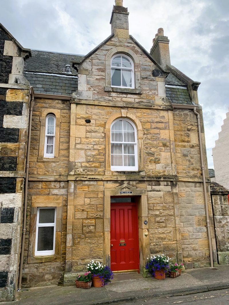
Entry Name: The Gable, 33-35 High Street, Earlsferry
Listing Name: Earlsferry, 33-35 High Street, the Gable
Listing Date: 18 August 1972
Category: C
Source: Historic Scotland
Source ID: 372252
Historic Scotland Designation Reference: LB31060
Building Class: Cultural
ID on this website: 200372252
Location: Elie and Earlsferry
County: Fife
Town: Elie And Earlsferry
Electoral Ward: East Neuk and Landward
Traditional County: Fife
Tagged with: Architectural structure
Originally late Georgian, 2-storey whin rubble with droved dressings, single Venetian at 1st floor: reconstructed and extended in Victorian times. 2-storey and attic sandstone addition in similar style; slated.
External links are from the relevant listing authority and, where applicable, Wikidata. Wikidata IDs may be related buildings as well as this specific building. If you want to add or update a link, you will need to do so by editing the Wikidata entry.


Other nearby listed buildings
