Approximate Location Map
Large Map »
Latitude: 56.1907 / 56°11'26"N
Longitude: -2.8188 / 2°49'7"W
OS Eastings: 349280
OS Northings: 700093
OS Grid: NO492000
Mapcode National: GBR 2Q.FW3K
Mapcode Global: WH7SR.NNXG
Plus Code: 9C8V55RJ+7F
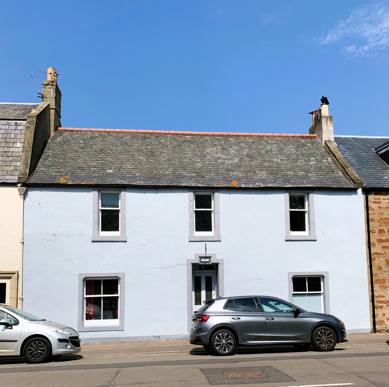
Entry Name: Homestead, 37 High Street, Elie
Listing Name: Elie 37 High Street Homestead
Listing Date: 8 January 1980
Category: C
Source: Historic Scotland
Source ID: 372125
Historic Scotland Designation Reference: LB30951
Building Class: Cultural
ID on this website: 200372125
Location: Elie and Earlsferry
County: Fife
Town: Elie And Earlsferry
Electoral Ward: East Neuk and Landward
Traditional County: Fife
Tagged with: House
Probably 18th altered 19th century. 2 storey, rendered and lined out as ashlar with painted stop chamfered margins. 3-window front with central door rising higher than windows. Ground floor windows wider than first floor ones. Reglazed 4-pane sashes ground floor, 2-pane above. Slated roof skew and stack right, mutual with 35A.
External links are from the relevant listing authority and, where applicable, Wikidata. Wikidata IDs may be related buildings as well as this specific building. If you want to add or update a link, you will need to do so by editing the Wikidata entry.


Other nearby listed buildings
