Approximate Location Map
Large Map »
Latitude: 56.2592 / 56°15'33"N
Longitude: -2.6284 / 2°37'42"W
OS Eastings: 361168
OS Northings: 707589
OS Grid: NO611075
Mapcode National: GBR 2Y.9PFD
Mapcode Global: WH8TL.LYL0
Plus Code: 9C8V795C+MJ
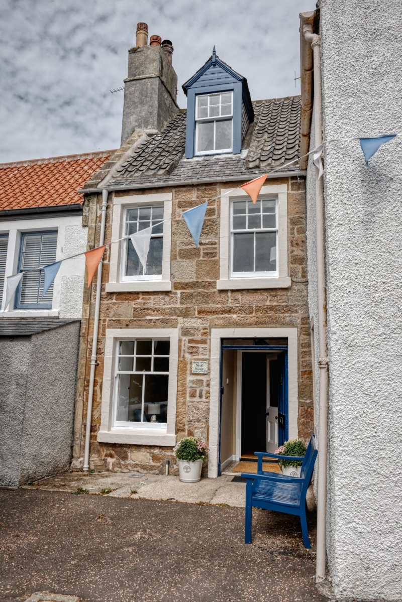
Entry Name: 59 High Street, Crail
Listing Name: 59 High Street
Listing Date: 9 May 1972
Category: C
Source: Historic Scotland
Source ID: 359059
Historic Scotland Designation Reference: LB23320
Building Class: Cultural
ID on this website: 200359059
Location: Crail
County: Fife
Town: Crail
Electoral Ward: East Neuk and Landward
Traditional County: Fife
Tagged with: Architectural structure
Circa 1800. 2-storey and attic 2-window coursed rubble with ground floor shop, pantiled with slate skirting, single dormer.
Re-categorised as C(S) from B for Group (2006). The listing relates specifically to the group interest of the subject. It applies, as always, to interior as well as exterior, as appropriate to building type.
External links are from the relevant listing authority and, where applicable, Wikidata. Wikidata IDs may be related buildings as well as this specific building. If you want to add or update a link, you will need to do so by editing the Wikidata entry.


Other nearby listed buildings
