Approximate Location Map
Large Map »
Latitude: 55.4801 / 55°28'48"N
Longitude: -4.4737 / 4°28'25"W
OS Eastings: 243766
OS Northings: 623477
OS Grid: NS437234
Mapcode National: GBR 3H.WXRF
Mapcode Global: WH3QX.7JX8
Plus Code: 9C7QFGJG+2G
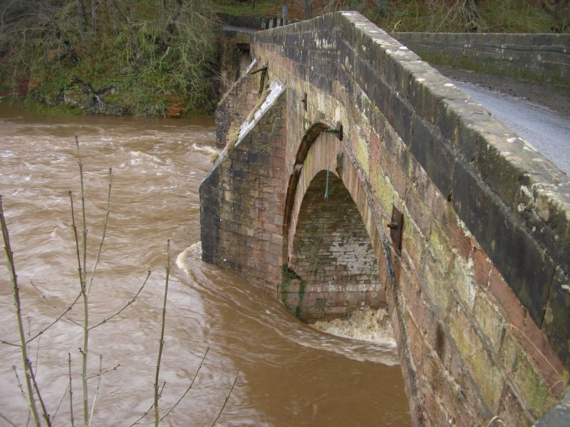
Entry Name: Stair Bridge
Listing Name: Stair Bridge
Listing Date: 14 April 1971
Category: A
Source: Historic Scotland
Source ID: 347697
Historic Scotland Designation Reference: LB14371
Building Class: Cultural
ID on this website: 200347697
Location: Stair
County: East Ayrshire
Electoral Ward: Kyle
Parish: Stair
Traditional County: Ayrshire
Tagged with: Arch bridge Road bridge Stone bridge
Built 1745. A narrow bidge of 3 arches spanning a bend of the
River Ayr.
External links are from the relevant listing authority and, where applicable, Wikidata. Wikidata IDs may be related buildings as well as this specific building. If you want to add or update a link, you will need to do so by editing the Wikidata entry.


Other nearby listed buildings
