Approximate Location Map
Large Map »
Latitude: 56.3244 / 56°19'27"N
Longitude: -3.4999 / 3°29'59"W
OS Eastings: 307340
OS Northings: 715677
OS Grid: NO073156
Mapcode National: GBR 1W.5KPJ
Mapcode Global: WH5PL.69NH
Plus Code: 9C8R8GF2+Q2
Entry Name: Muckersie Chapel
Listing Name: Muckersie Chapel.
Listing Date: 9 June 1981
Category: C
Source: Historic Scotland
Source ID: 343644
Historic Scotland Designation Reference: LB11079
Building Class: Cultural
ID on this website: 200343644
Location: Forteviot
County: Perth and Kinross
Electoral Ward: Almond and Earn
Parish: Forteviot
Traditional County: Perthshire
Tagged with: Chapel Architectural structure
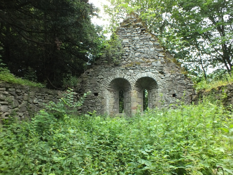
First mentioned 1181/5, former parish church of
Muckersie. Reconstructed as burial place for Belshes of
Invermay probably c. 1840. Crowstepped rectangle
rubble-built with round arched gothic doorway, splayed
and hood moulded. Traces of blocked up openings inside
of S. wall. 2 small E. windows externally of c. 1840,
inner rear arches might be in part original.
Muckersie Parish was united with Forteviot in 1618.
External links are from the relevant listing authority and, where applicable, Wikidata. Wikidata IDs may be related buildings as well as this specific building. If you want to add or update a link, you will need to do so by editing the Wikidata entry.


Other nearby listed buildings
