Approximate Location Map
Large Map »
Latitude: 50.2266 / 50°13'35"N
Longitude: -5.24 / 5°14'24"W
OS Eastings: 169000
OS Northings: 41317
OS Grid: SW690413
Mapcode National: GBR Z3.DSQ8
Mapcode Global: VH12K.4K4M
Plus Code: 9C2P6QG5+MX
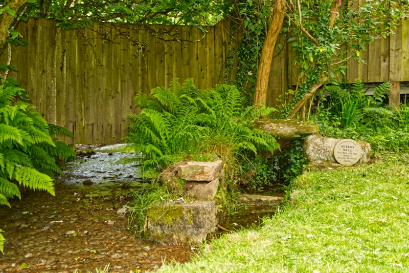
Entry Name: St Eunys Well
Listing Date: 4 October 2005
Grade: II
Source: Historic England
Source ID: 1392501
English Heritage Legacy ID: 490359
ID on this website: 101392501
Location: Carn Brea Village, Cornwall, TR15
County: Cornwall
Civil Parish: Carn Brea
Traditional County: Cornwall
Lieutenancy Area (Ceremonial County): Cornwall
Church of England Parish: Redruth
Church of England Diocese: Truro
Tagged with: Well
CARN BREA
1535/0/10045 CARN BREA VILLAGE
04-OCT-05 St Euny's Well
II
Holy well. Medieval origin. Large granite stones, somewhat displaced and overgrown, but still enclosing the well at the side of a stream.
HISTORICAL NOTE: St Euny, the Celtic missionary, came to Cornwall in the C7 and by tradition this well at Carn Brea has always been associated with the Saint.
SOURCE: Quiller Couch, A., Ancient and Holy Wells of Cornwall.
DCMS agree yes list
External links are from the relevant listing authority and, where applicable, Wikidata. Wikidata IDs may be related buildings as well as this specific building. If you want to add or update a link, you will need to do so by editing the Wikidata entry.


Other nearby listed buildings
