Approximate Location Map
Large Map »
Latitude: 51.3908 / 51°23'26"N
Longitude: 0.398 / 0°23'52"E
OS Eastings: 566936
OS Northings: 168476
OS Grid: TQ669684
Mapcode National: GBR NN5.RF0
Mapcode Global: VHJLR.V97P
Plus Code: 9F3299RX+85
Entry Name: The Village Pump
Listing Date: 26 July 1983
Grade: II
Source: Historic England
Source ID: 1350223
English Heritage Legacy ID: 356757
ID on this website: 101350223
Location: Cobham, Gravesham, Kent, DA12
County: Kent
District: Gravesham
Civil Parish: Cobham
Built-Up Area: Cobham
Traditional County: Kent
Lieutenancy Area (Ceremonial County): Kent
Church of England Parish: Cobham St Mary Magdalene
Church of England Diocese: Rochester
Tagged with: Architectural structure
TQ 66 NE
5/28
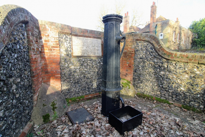
COBHAM
THE STREET (north side)
The Village Pump
II
1848. Octagonal iron pump set in a recess formed by one storey height curved screen wall of red brick with flint panels and a central stone panel recording the date of re-erection and re-building by Lord Darnley.
Listing NGR: TQ6700468398
External links are from the relevant listing authority and, where applicable, Wikidata. Wikidata IDs may be related buildings as well as this specific building. If you want to add or update a link, you will need to do so by editing the Wikidata entry.


Other nearby listed buildings
