Approximate Location Map
Large Map »
Latitude: 51.3848 / 51°23'5"N
Longitude: 1.384 / 1°23'2"E
OS Eastings: 635558
OS Northings: 170522
OS Grid: TR355705
Mapcode National: GBR WZZ.2QM
Mapcode Global: VHLG6.YG17
Plus Code: 9F3399MM+WJ
Entry Name: 11, Charlotte Square
Listing Date: 22 February 1973
Grade: II
Source: Historic England
Source ID: 1341509
English Heritage Legacy ID: 356517
ID on this website: 101341509
Location: Margate, Thanet, Kent, CT9
County: Kent
District: Thanet
Electoral Ward/Division: Margate Central
Parish: Non Civil Parish
Built-Up Area: Margate
Traditional County: Kent
Lieutenancy Area (Ceremonial County): Kent
Tagged with: Building
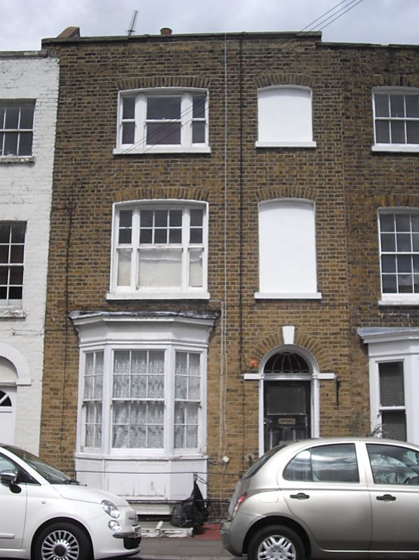
CHARLOTTE SQUARE
1.
1380
(North East Side)
No 11
TR 3570 NE 6/129
II GV
2.
Early C19. 3 storeys and basement brown brick, stone coping. 1 cambered
triple sash, 1 blank. Ground floor has left side 3-light canted bay and right
side round-headed doorcase with fanlight and panelled reveals.
No 3, Nos 7 to 11 (odd) and No 15 form a group
Listing NGR: TR3555870522
External links are from the relevant listing authority and, where applicable, Wikidata. Wikidata IDs may be related buildings as well as this specific building. If you want to add or update a link, you will need to do so by editing the Wikidata entry.


Other nearby listed buildings
