Approximate Location Map
Large Map »
Latitude: 51.9351 / 51°56'6"N
Longitude: -0.6011 / 0°36'3"W
OS Eastings: 496273
OS Northings: 227213
OS Grid: SP962272
Mapcode National: GBR F2Z.QTK
Mapcode Global: VHFR4.JMLD
Plus Code: 9C3XW9PX+2H
Entry Name: The Grange
Listing Date: 29 April 1952
Last Amended: 26 September 1980
Grade: II
Source: Historic England
Source ID: 1311390
English Heritage Legacy ID: 35988
ID on this website: 101311390
Location: Church End, Central Bedfordshire, LU7
County: Central Bedfordshire
Civil Parish: Hockliffe
Traditional County: Bedfordshire
Lieutenancy Area (Ceremonial County): Bedfordshire
Church of England Parish: Hockliffe
Church of England Diocese: St.Albans
Tagged with: Building
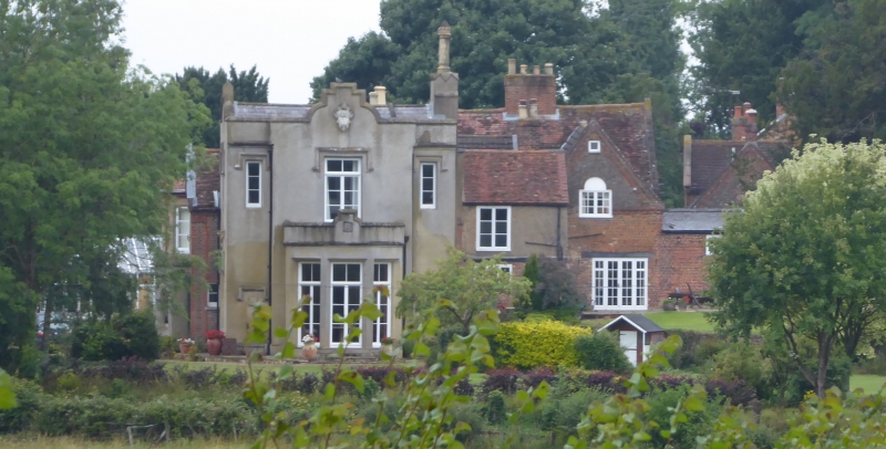
1.
5125 HOCKLIFFE CHURCH END: CHURCH LANE
The Grange
(formerly listed as
Hockliffe Grange)
SP 9627 10/159 29.4.52
II
2.
C17 and C18, much altered. C19 and modern additions. Originally of red and vitrified
brick. Two storeys. Clay tile roof. Front retains first floor Venetian window
under brick modillion cornice and gable.
Listing NGR: SP9627327213
External links are from the relevant listing authority and, where applicable, Wikidata. Wikidata IDs may be related buildings as well as this specific building. If you want to add or update a link, you will need to do so by editing the Wikidata entry.


Other nearby listed buildings
