Approximate Location Map
Large Map »
Latitude: 53.3738 / 53°22'25"N
Longitude: -2.8681 / 2°52'5"W
OS Eastings: 342340
OS Northings: 386677
OS Grid: SJ423866
Mapcode National: GBR 8YDF.V9
Mapcode Global: WH87G.XGDF
Plus Code: 9C5V94FJ+GQ
Entry Name: 14 and 16, Woolton High Street
Listing Date: 14 March 1975
Grade: II
Source: Historic England
Source ID: 1291825
English Heritage Legacy ID: 359763
ID on this website: 101291825
Location: Woolton, Liverpool, Merseyside, L25
County: Liverpool
Electoral Ward/Division: Woolton
Parish: Non Civil Parish
Built-Up Area: Liverpool
Traditional County: Lancashire
Lieutenancy Area (Ceremonial County): Merseyside
Church of England Parish: Much Woolton St Peter
Church of England Diocese: Liverpool
Tagged with: Building
SJ 4286
44/1380
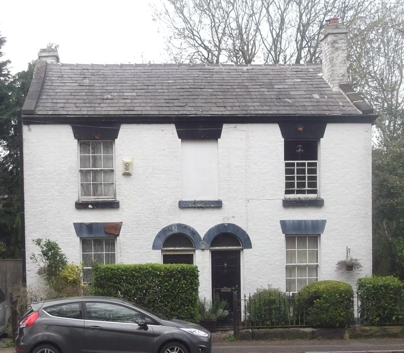
WOOLTON HIGH STREET, L25
Nos. 14 & 16
14.3.75.
G.V. II
Pair of houses. Early C19. Brick with stone dressings,
slate roof. 2 storeys, 3 bays to pair. Top cornice. Windows have
wedge lintels and are sashed with glazing bars. Paired
round-headed entrances and blind window above. No. 14 has
6-panel door.
Listing NGR: SJ4234086677
External links are from the relevant listing authority and, where applicable, Wikidata. Wikidata IDs may be related buildings as well as this specific building. If you want to add or update a link, you will need to do so by editing the Wikidata entry.


Other nearby listed buildings
