Approximate Location Map
Large Map »
Latitude: 53.5761 / 53°34'34"N
Longitude: -2.8176 / 2°49'3"W
OS Eastings: 345960
OS Northings: 409147
OS Grid: SD459091
Mapcode National: GBR 8WR2.SS
Mapcode Global: WH86J.PCHT
Plus Code: 9C5VH5GJ+FX
Entry Name: Lathom House, former west wing
Listing Date: 11 August 1972
Last Amended: 1 March 1993
Grade: II*
Source: Historic England
Source ID: 1290908
English Heritage Legacy ID: 386290
ID on this website: 101290908
Location: Lathom, West Lancashire, L40
County: Lancashire
District: West Lancashire
Civil Parish: Lathom
Traditional County: Lancashire
Lieutenancy Area (Ceremonial County): Lancashire
Church of England Parish: Ormskirk St Peter and St Paul
Church of England Diocese: Liverpool
Tagged with: Archaeological site English country house
This list entry was subject to a Minor Amendment on 07/08/2020
SD40NE
663-1/5/55
LATHOM
HALL LANE (East side (off))
Lathom House, former west wing
(Formerly Listed as: ORMSKIRK, LATHOM, Remains of Lathom Hall)
11/08/72
GV
II*
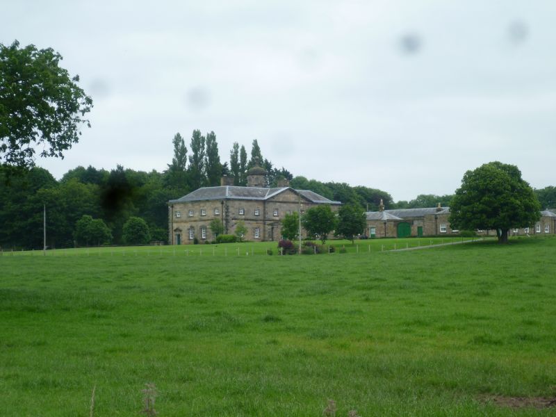
Wing of former country house. c.1730. By Giacomo Leoni; with additions to rear c.1862 by Mr Wyatt.
Sandstone ashlar, slate roof (formerly hipped). Rectangular double-depth plan on north-south axis, facing east, with a central through-passage; and various outbuildings arranged around a double courtyard to the rear. Palladian style.
Two storeys, 2:3:2 bays, the centre pedimented and breaking forwards slightly; with a plinth, banded quoins, first-floor band, and a moulded cornice with blocking course. The centre has a large round-headed archway with an architrave including banded semicolumns, run-out voussoirs, a panelled keystone and a cornice with blocking course, and damaged wooden gates. The ground floor has tall windows with Gibbs surrounds and cornices (all now boarded), and the first floor has small square windows with raised sills but otherwise plain surrounds.
Rising from the centre of the roof is an octagonal cupola with an oeil-de-boeuf in each side (some with remains of wooden louvres), a moulded cornice and an ogival stone cap with a large ball finial surmounted by a weathervane; and to each side is a chimney stack. The four-bay north return side (which is now propped with timber buttresses) has a doorway near each corner with triple keystone and pedimented Gibbs surround, Two windows between these with triple keystones and Gibbs surrounds, and at first floor four small windows like those at the front. The rear elevation is similar but simpler. The attached stable yard ranges are single-storey stables, coach-houses, etc, very much dilapidated at time of survey (1991).
INTERIOR: very badly dilapidated at time of survey, the floors and roof of the northern portion collapsed, but the southern portion has remains of the plank panelling of former horse stalls.
Forms group with remains of garden wall attached to north-east corner (q.v.) and with ha-ha bounding south and east sides of former garden (q.v.).
Listing NGR: SD4596009147
External links are from the relevant listing authority and, where applicable, Wikidata. Wikidata IDs may be related buildings as well as this specific building. If you want to add or update a link, you will need to do so by editing the Wikidata entry.


Other nearby listed buildings
