Approximate Location Map
Large Map »
Latitude: 52.0258 / 52°1'32"N
Longitude: -1.0169 / 1°1'0"W
OS Eastings: 467546
OS Northings: 236835
OS Grid: SP675368
Mapcode National: GBR 9X9.V10
Mapcode Global: VHDT2.BB7V
Plus Code: 9C4W2XGM+86
Entry Name: The Hermitage
Listing Date: 13 July 1966
Last Amended: 21 April 1983
Grade: I
Source: Historic England
Source ID: 1289654
English Heritage Legacy ID: 396655
ID on this website: 101289654
Location: Buckinghamshire, MK18
County: Buckinghamshire
Civil Parish: Stowe
Traditional County: Buckinghamshire
Lieutenancy Area (Ceremonial County): Buckinghamshire
Church of England Parish: Stowe
Church of England Diocese: Oxford
Tagged with: Architectural structure
SP 63 NE STOWE
3/84 STOWE SCHOOL
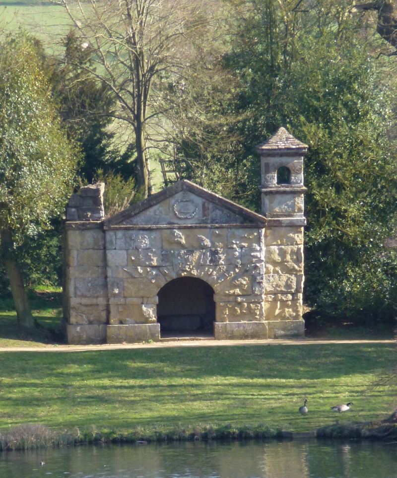
The Hermitage (or
Shepherds Cove)
(formerly listed as
Shepherd's Cote (or
Cove as marked on
Ordnance Map))
13.7.66
I
Sham ruin pre-1732 by Kent. Rock faced stone, eliptical arched opening
with heavy voussoirs; carved wreath with panpipes in pediment, small incomplete
turret on right with round arched opening.
Listing NGR: SP6754636835
External links are from the relevant listing authority and, where applicable, Wikidata. Wikidata IDs may be related buildings as well as this specific building. If you want to add or update a link, you will need to do so by editing the Wikidata entry.


Other nearby listed buildings
