Approximate Location Map
Large Map »
Latitude: 53.6558 / 53°39'20"N
Longitude: -1.7877 / 1°47'15"W
OS Eastings: 414128
OS Northings: 417718
OS Grid: SE141177
Mapcode National: GBR HVY5.R7
Mapcode Global: WHCB1.HCYR
Plus Code: 9C5WM646+8W
Entry Name: Wall Around Church of St John
Listing Date: 29 September 1978
Grade: II
Source: Historic England
Source ID: 1277388
English Heritage Legacy ID: 407032
ID on this website: 101277388
Location: St John's Church, Shearing Cross, Kirklees, West Yorkshire, HD1
County: Kirklees
Electoral Ward/Division: Greenhead
Parish: Non Civil Parish
Built-Up Area: Huddersfield
Traditional County: Yorkshire
Lieutenancy Area (Ceremonial County): West Yorkshire
Church of England Parish: St John the Evangelist Huddersfield
Church of England Diocese: Leeds
Tagged with: Wall
ST JOHN'S ROAD
1.
5113
(West Side)
Bay Hall
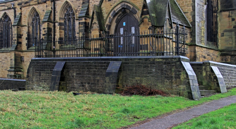
SE 1417 28/1168 Wall around Church of St John
II
2.
1851-3. Dwarf stone wall with simple iron railings.
Listing NGR: SE1412817718
External links are from the relevant listing authority and, where applicable, Wikidata. Wikidata IDs may be related buildings as well as this specific building. If you want to add or update a link, you will need to do so by editing the Wikidata entry.


Other nearby listed buildings
