Approximate Location Map
Large Map »
Latitude: 51.3821 / 51°22'55"N
Longitude: 0.293 / 0°17'34"E
OS Eastings: 559664
OS Northings: 167273
OS Grid: TQ596672
Mapcode National: GBR Y4.LK4
Mapcode Global: VHHP8.1J7C
Plus Code: 9F3297JV+R5
Entry Name: Pennis House
Listing Date: 22 October 1982
Grade: II
Source: Historic England
Source ID: 1274170
English Heritage Legacy ID: 415693
ID on this website: 101274170
Location: Hartley, Sevenoaks, Kent, DA3
County: Kent
District: Sevenoaks
Civil Parish: Fawkham
Traditional County: Kent
Lieutenancy Area (Ceremonial County): Kent
Church of England Parish: Hartley All Saints
Church of England Diocese: Rochester
Tagged with: House
FAWKHAM PENUS LANE
1.
5280
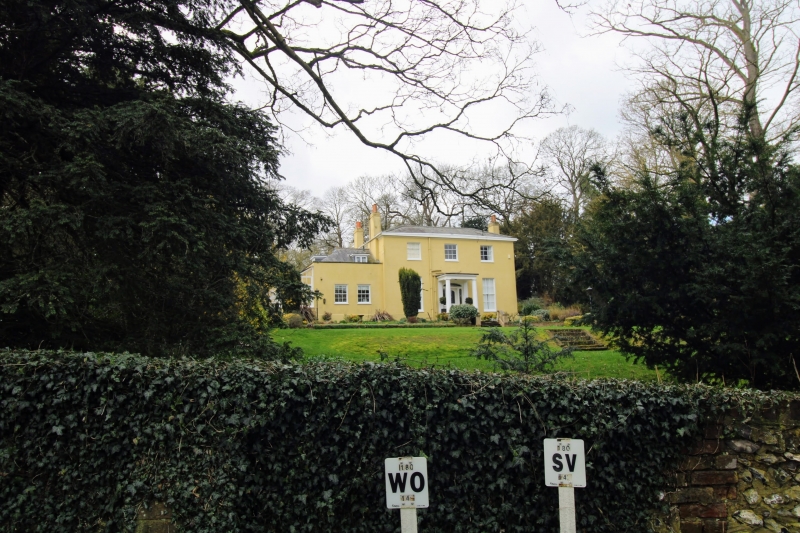
Pennis House
TQ 56 NE 3/145
II GV
Early C19. Two storeys stuccoed. Ripped slate roof. Three sashes with glazing bars
intact. Portico with Doric columns.
Listing NGR: TQ5965767270
External links are from the relevant listing authority and, where applicable, Wikidata. Wikidata IDs may be related buildings as well as this specific building. If you want to add or update a link, you will need to do so by editing the Wikidata entry.


Other nearby listed buildings
