Approximate Location Map
Large Map »
Latitude: 52.8421 / 52°50'31"N
Longitude: -2.1733 / 2°10'23"W
OS Eastings: 388421
OS Northings: 327187
OS Grid: SJ884271
Mapcode National: GBR 168.WXL
Mapcode Global: WHBDL.LT9K
Plus Code: 9C4VRRRG+RM
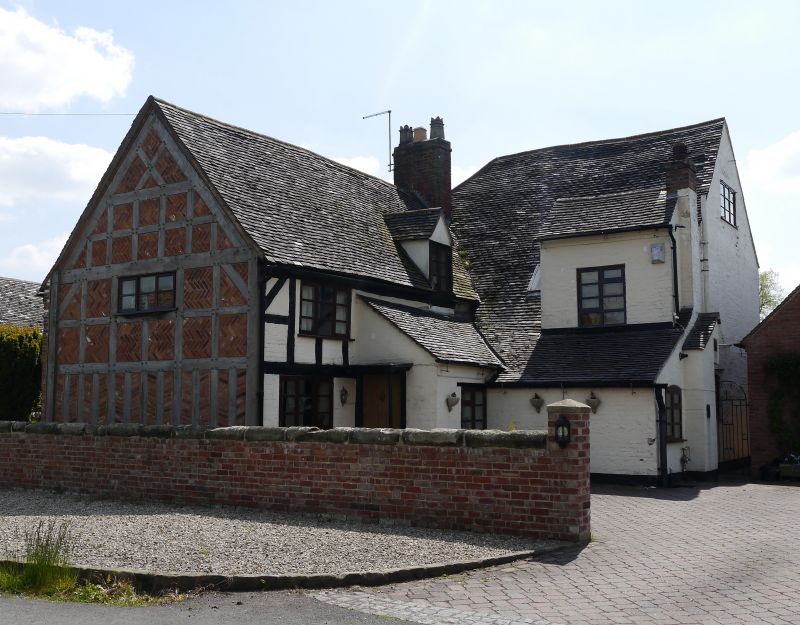
Entry Name: The Gables
Listing Date: 15 January 1968
Grade: II
Source: Historic England
Source ID: 1259775
English Heritage Legacy ID: 444180
ID on this website: 101259775
Location: Great Bridgeford, Stafford, Staffordshire, ST18
County: Staffordshire
District: Stafford
Civil Parish: Seighford
Traditional County: Staffordshire
Lieutenancy Area (Ceremonial County): Staffordshire
Church of England Parish: Seighford St Chad
Church of England Diocese: Lichfield
Tagged with: Architectural structure
1
2385
SJ 82 NE
12/17
15.1.68
SEIGHFORD
The Gables
Cherry Lane
II
2.
Late C16 with later alterations Irregular on plan. Timber framed and
colour-washed brick with tiled roof and brick stacks; 2 storeys and attic;
sash and casement windows (some modern); 3 window front. 2 storeyed porch.
Listing NGR: SJ8842127187
External links are from the relevant listing authority and, where applicable, Wikidata. Wikidata IDs may be related buildings as well as this specific building. If you want to add or update a link, you will need to do so by editing the Wikidata entry.


Other nearby listed buildings
