Approximate Location Map
Large Map »
Latitude: 52.7097 / 52°42'34"N
Longitude: -2.7629 / 2°45'46"W
OS Eastings: 348557
OS Northings: 312720
OS Grid: SJ485127
Mapcode National: GBR BJ.26J9
Mapcode Global: WH8BT.J5K0
Plus Code: 9C4VP65P+VV
Entry Name: 41-52, New Street
Listing Date: 19 September 1972
Grade: II
Source: Historic England
Source ID: 1254666
English Heritage Legacy ID: 457709
ID on this website: 101254666
Location: Frankwell, Shropshire, SY3
County: Shropshire
Civil Parish: Shrewsbury
Built-Up Area: Shrewsbury
Traditional County: Shropshire
Lieutenancy Area (Ceremonial County): Shropshire
Church of England Parish: St George of Cappadocia, Shrewsbury
Church of England Diocese: Lichfield
Tagged with: Building
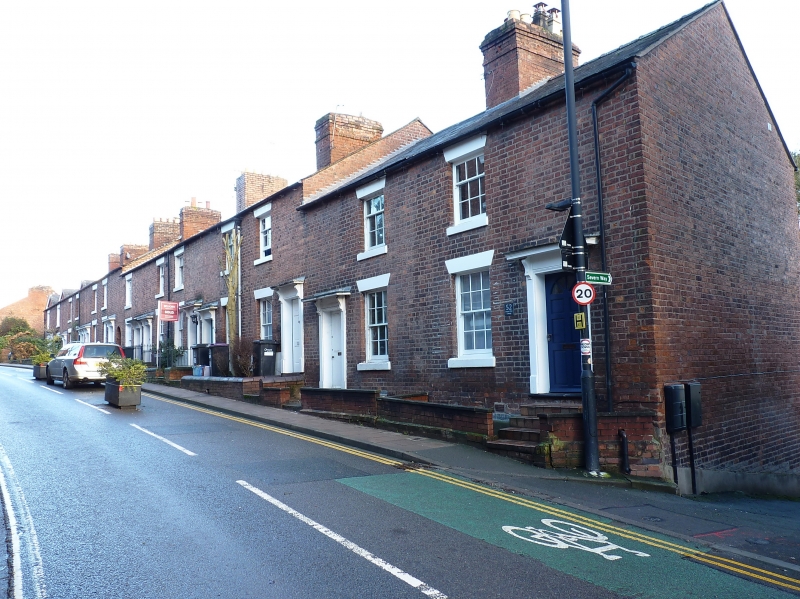
SHREWSBURY
SJ4812NE NEW STREET
653-1/10/464 (South East side)
Nos.41-52 (Consecutive)
GV II
Terrace of 12 houses. c1840. Brick with Welsh slate roof. 2
storeys, each house a single-window range. Doorways with
simply moulded architraves and panelled doors, some now
replaced. 12-pane sash windows, with flat-arched heads to
ground floor. End wall stacks.
Listing NGR: SJ4855712720
External links are from the relevant listing authority and, where applicable, Wikidata. Wikidata IDs may be related buildings as well as this specific building. If you want to add or update a link, you will need to do so by editing the Wikidata entry.


Other nearby listed buildings
