Approximate Location Map
Large Map »
Latitude: 52.3975 / 52°23'50"N
Longitude: 0.2694 / 0°16'9"E
OS Eastings: 554500
OS Northings: 280138
OS Grid: TL545801
Mapcode National: GBR M6H.NY0
Mapcode Global: VHHJ6.MZ8Z
Plus Code: 9F4297W9+XP
Entry Name: 4 and 6, Waterside
Listing Date: 19 June 1972
Grade: II
Source: Historic England
Source ID: 1252357
English Heritage Legacy ID: 435359
ID on this website: 101252357
Location: Ely, East Cambridgeshire, CB7
County: Cambridgeshire
District: East Cambridgeshire
Civil Parish: Ely
Built-Up Area: Ely
Traditional County: Cambridgeshire
Lieutenancy Area (Ceremonial County): Cambridgeshire
Church of England Parish: Ely
Church of England Diocese: Ely
Tagged with: Building
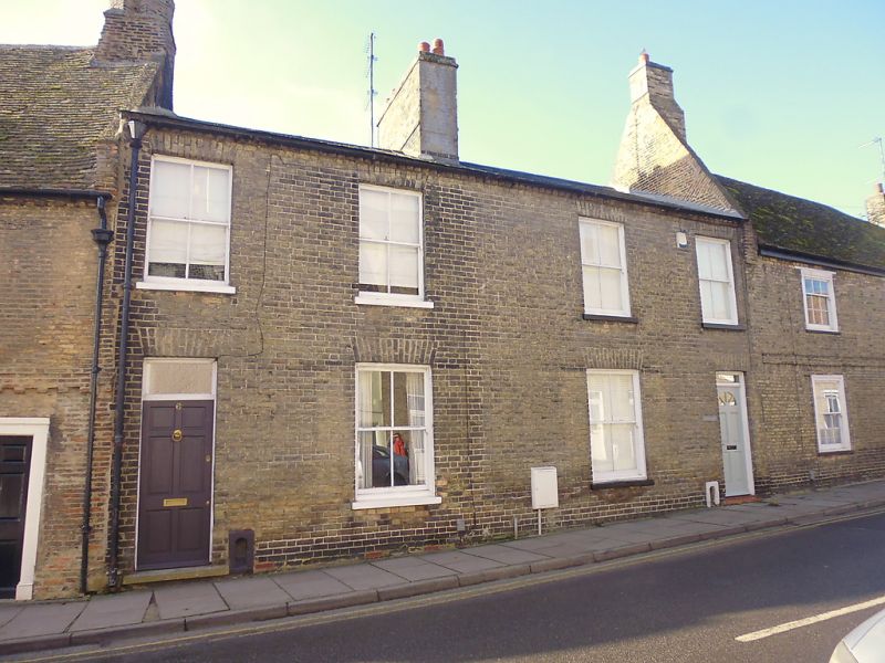
WATERSIDE
1.
1082
(West Side)
Nos 4 & 6
TL 5479 2/223
II GV
2.
Early C19 brick houses. 2 storeys. 4 window range, double-hung sashes
with glazing bars, in plain reveals. The doorways have plain rectangular
fanlights and plain reveals. Roofs slate. Included for group value.
Nos 2 to 12 (even) form a group with Nos 1 to 25 (odd) & No 58 Fore Hill.
Listing NGR: TL5450080138
External links are from the relevant listing authority and, where applicable, Wikidata. Wikidata IDs may be related buildings as well as this specific building. If you want to add or update a link, you will need to do so by editing the Wikidata entry.


Other nearby listed buildings
