Approximate Location Map
Large Map »
Latitude: 50.9741 / 50°58'26"N
Longitude: -0.7399 / 0°44'23"W
OS Eastings: 488570
OS Northings: 120161
OS Grid: SU885201
Mapcode National: GBR DF2.ZQD
Mapcode Global: FRA 96BJ.PLG
Plus Code: 9C2XX7F6+J3
Entry Name: The Royal Oak Public House
Listing Date: 26 November 1987
Grade: II
Source: Historic England
Source ID: 1221480
English Heritage Legacy ID: 413297
ID on this website: 101221480
Location: Cocking Causeway, Chichester, West Sussex, GU29
County: West Sussex
District: Chichester
Civil Parish: West Lavington
Traditional County: Sussex
Lieutenancy Area (Ceremonial County): West Sussex
Church of England Parish: Cocking with West Lavington
Church of England Diocese: Chichester
Tagged with: Pub
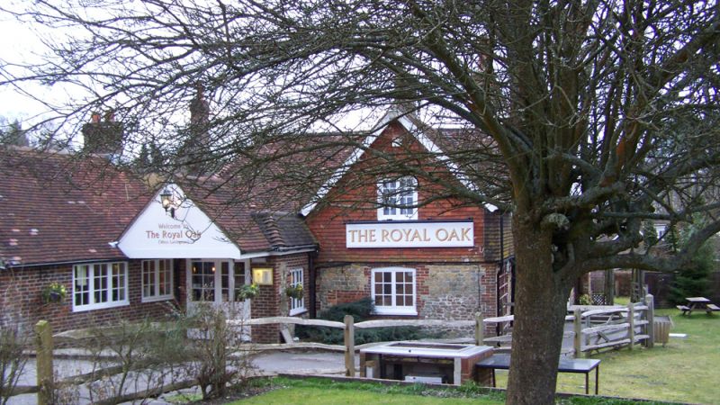
SU 82 SE WEST LAVINGTON CHICHESTER ROAD
11/49 The Royal Oak Public
- House.
- II
Public House. L-shaped C17 timber-framed building refaced with Wealden sandstone rubble on round floor and tile-hung above; the north wing red brick and grey headers. Tiled roof. Casement windows. 2 storeys. 3 windows.
Listing NGR: SU8857020161
External links are from the relevant listing authority and, where applicable, Wikidata. Wikidata IDs may be related buildings as well as this specific building. If you want to add or update a link, you will need to do so by editing the Wikidata entry.


Other nearby listed buildings
