Approximate Location Map
Large Map »
Latitude: 50.7347 / 50°44'4"N
Longitude: -2.7629 / 2°45'46"W
OS Eastings: 346255
OS Northings: 93066
OS Grid: SY462930
Mapcode National: GBR PP.03S3
Mapcode Global: FRA 5734.FFX
Plus Code: 9C2VP6MP+VR
Entry Name: Allington Villa
Listing Date: 28 November 1950
Grade: II
Source: Historic England
Source ID: 1216363
English Heritage Legacy ID: 401660
ID on this website: 101216363
Location: Allington, Dorset, DT6
County: Dorset
Civil Parish: Bridport
Built-Up Area: Bridport
Traditional County: Dorset
Lieutenancy Area (Ceremonial County): Dorset
Church of England Parish: Bridport St Mary
Church of England Diocese: Salisbury
Tagged with: Villa
1.
5191 NORTH ALLINGTON
(East Side)
Allington Villa
SY 4693 2/5 28.11.50
II
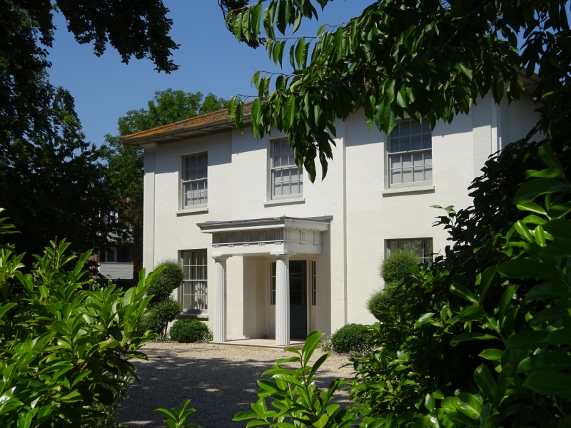
2.
Early or mid C19. Stucco. Hipped slate roof with wide eaves and brackets.
2 storeys. Angle pilasters. 3 ranges of sashes with glazing bars. Porch
in antis with Greek Doric columns, entablature with triglyphs and guttae.
Door with 2 moulded panels.
Listing NGR: SY4625593066
External links are from the relevant listing authority and, where applicable, Wikidata. Wikidata IDs may be related buildings as well as this specific building. If you want to add or update a link, you will need to do so by editing the Wikidata entry.


Other nearby listed buildings
