Approximate Location Map
Large Map »
Latitude: 52.9235 / 52°55'24"N
Longitude: -1.4827 / 1°28'57"W
OS Eastings: 434875
OS Northings: 336357
OS Grid: SK348363
Mapcode National: GBR PJF.2C
Mapcode Global: WHDGT.6S64
Plus Code: 9C4WWGF8+CW
Entry Name: 11, Friar Gate
Listing Date: 24 February 1977
Grade: II
Source: Historic England
Source ID: 1216189
English Heritage Legacy ID: 401527
ID on this website: 101216189
Location: Derby, Derbyshire, DE1
County: City of Derby
Electoral Ward/Division: Arboretum
Parish: Non Civil Parish
Built-Up Area: Derby
Traditional County: Derbyshire
Lieutenancy Area (Ceremonial County): Derbyshire
Church of England Parish: Derby St Alkmund and St Werburgh
Church of England Diocese: Derby
Tagged with: Building
FRIAR GATE
1.
5170
(North Side)
No 11
SK 343
6 SE 4/94
II
2.
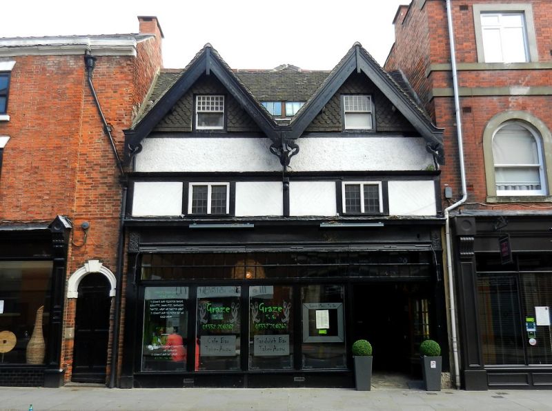
An early but much restored timber-framed house; 2 storeys and attic in gables;
2 plain gables with restored bargeboards. Formerly a Public House but converted
into modern shop. Interior retains ceiling beams and much of original character.
Listing NGR: SK3487536357
External links are from the relevant listing authority and, where applicable, Wikidata. Wikidata IDs may be related buildings as well as this specific building. If you want to add or update a link, you will need to do so by editing the Wikidata entry.


Other nearby listed buildings
