Approximate Location Map
Large Map »
Latitude: 53.6234 / 53°37'24"N
Longitude: -1.7575 / 1°45'26"W
OS Eastings: 416139
OS Northings: 414122
OS Grid: SE161141
Mapcode National: GBR JV5J.9V
Mapcode Global: WHCB7.Z682
Plus Code: 9C5WJ6FV+92
Entry Name: 54 Lumb Lane
Listing Date: 29 September 1978
Grade: II
Source: Historic England
Source ID: 1215607
English Heritage Legacy ID: 340194
ID on this website: 101215607
Location: Almondbury Common, Kirklees, West Yorkshire, HD4
County: Kirklees
Electoral Ward/Division: Almondbury
Parish: Non Civil Parish
Built-Up Area: Huddersfield
Traditional County: Yorkshire
Lieutenancy Area (Ceremonial County): West Yorkshire
Church of England Parish: Almondbury with Farnley Tyas Team Parish
Church of England Diocese: Leeds
Tagged with: Building
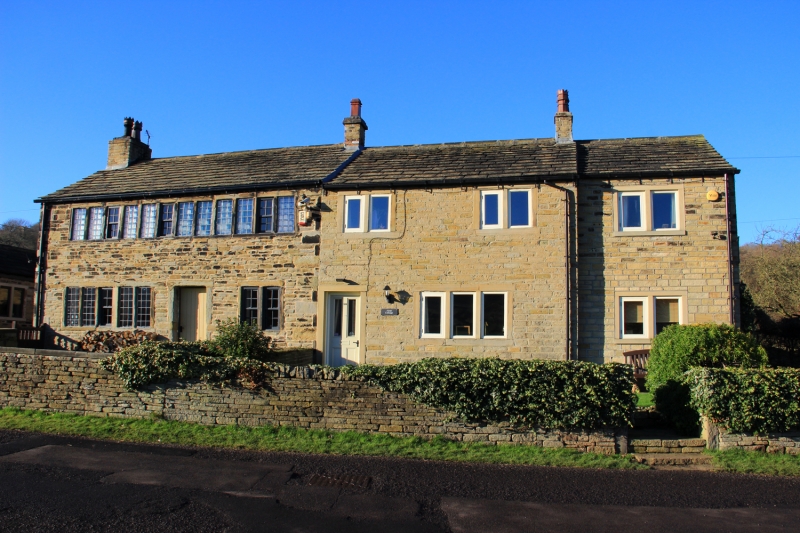
LUMB LANE
1.
5113
(North Side)
Almondbury
No 54
SE 1614 45/872
II
2.
C19. Hammer-dressed stone. Pitched stone slate roof. 2 storeys. Two 2-light stone mullioned casements on 1st floor, one on ground floor.
Listing NGR: SE1613914122
External links are from the relevant listing authority and, where applicable, Wikidata. Wikidata IDs may be related buildings as well as this specific building. If you want to add or update a link, you will need to do so by editing the Wikidata entry.


Other nearby listed buildings
