Approximate Location Map
Large Map »
Latitude: 54.2038 / 54°12'13"N
Longitude: -2.5986 / 2°35'55"W
OS Eastings: 361047
OS Northings: 478842
OS Grid: SD610788
Mapcode National: GBR BM9T.6S
Mapcode Global: WH94P.1LTM
Plus Code: 9C6V6C32+GG
Entry Name: 3, Fairbank
Listing Date: 22 March 1983
Grade: II
Source: Historic England
Source ID: 1145808
English Heritage Legacy ID: 75132
ID on this website: 101145808
Location: Kirkby Lonsdale, Westmorland and Furness, Cumbria, LA6
County: Cumbria
District: South Lakeland
Civil Parish: Kirkby Lonsdale
Built-Up Area: Kirkby Lonsdale
Traditional County: Westmorland
Lieutenancy Area (Ceremonial County): Cumbria
Church of England Parish: Kirkby Lonsdale Team Ministry
Church of England Diocese: Carlisle
Tagged with: Building
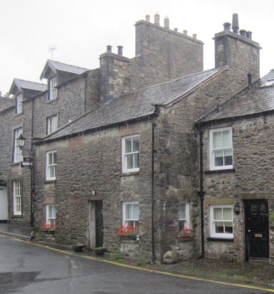
FAIRBANK
1.
5166 (north side)
No 3
SD 6178 NW 5/22 GV
II
2.
C18 cottage, originally two. Two storeys. Rubble. Slate roof. Two chimneys.
Quoins. Coping and kneelers to gable ends. Two windows with sills and plain reveals,
sashed. Thin stone surround to doorway. Two blocked windows on first floor. Blocked
doorway.
Listing NGR: SD6104778842
External links are from the relevant listing authority and, where applicable, Wikidata. Wikidata IDs may be related buildings as well as this specific building. If you want to add or update a link, you will need to do so by editing the Wikidata entry.


Other nearby listed buildings
