Approximate Location Map
Large Map »
Latitude: 51.9313 / 51°55'52"N
Longitude: -0.587 / 0°35'13"W
OS Eastings: 497246
OS Northings: 226806
OS Grid: SP972268
Mapcode National: GBR F30.VT3
Mapcode Global: VHFR4.SQ0B
Plus Code: 9C3XWCJ7+G5
Entry Name: Hockliffe Dairy Farmhouse
Listing Date: 26 September 1980
Grade: II
Source: Historic England
Source ID: 1114697
English Heritage Legacy ID: 35993
ID on this website: 101114697
Location: Hockliffe, Central Bedfordshire, LU7
County: Central Bedfordshire
Civil Parish: Hockliffe
Built-Up Area: Hockliffe
Traditional County: Bedfordshire
Lieutenancy Area (Ceremonial County): Bedfordshire
Church of England Parish: Hockliffe
Church of England Diocese: St.Albans
Tagged with: Farmhouse
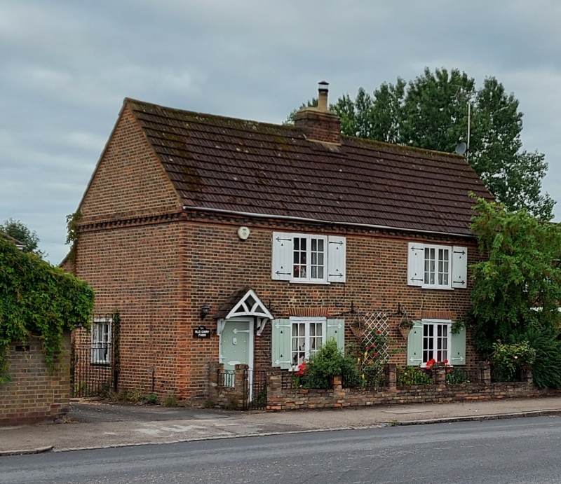
1.
5125 HOCKLIFFE WATLING STREET
(south-west side)
Hockliffe Dairy Farmhouse
SP 9726 13/166
II
2.
C18, Red and grey brick. Two storeys. Concrete tile roof. Two casements with
glazing bars.
Listing NGR: SP9724626806
External links are from the relevant listing authority and, where applicable, Wikidata. Wikidata IDs may be related buildings as well as this specific building. If you want to add or update a link, you will need to do so by editing the Wikidata entry.


Other nearby listed buildings
