Approximate Location Map
Large Map »
Latitude: 52.0903 / 52°5'25"N
Longitude: -0.2677 / 0°16'3"W
OS Eastings: 518776
OS Northings: 244966
OS Grid: TL187449
Mapcode National: GBR H44.YZG
Mapcode Global: VHGN0.9QTF
Plus Code: 9C4X3PRJ+4W
Entry Name: 55, Shortmead Street
Listing Date: 7 December 1978
Grade: II
Source: Historic England
Source ID: 1114496
English Heritage Legacy ID: 37478
ID on this website: 101114496
Location: Biggleswade, Central Bedfordshire, SG18
County: Central Bedfordshire
Civil Parish: Biggleswade
Built-Up Area: Biggleswade
Traditional County: Bedfordshire
Lieutenancy Area (Ceremonial County): Bedfordshire
Church of England Parish: Biggleswade
Church of England Diocese: St.Albans
Tagged with: Building
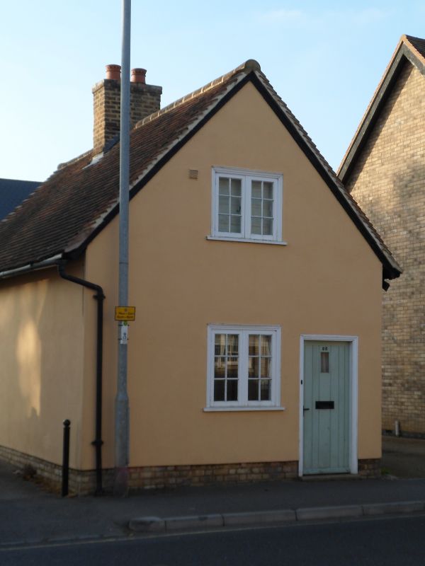
SHORTMEAD STREET
1.
5124
(West Side)
No 55
TL 1844 1/52
II GV
2.
C17 or early C18. Pebbledash, one storey and attics. Old clay tile roof. Gable
end to road. Two Yorkshire casements to north elevation. East gable end has
attic casement windows with glazing bars, ground floor modern 2-light casement.
Included for group value.
Listing NGR: TL1877644966
External links are from the relevant listing authority and, where applicable, Wikidata. Wikidata IDs may be related buildings as well as this specific building. If you want to add or update a link, you will need to do so by editing the Wikidata entry.


Other nearby listed buildings
